The World's Leading Augmented Reality Platform
Imagine · Create · Experience
Where Imagination Meets Reality
Trusted by 200,000+ developers worldwide
EasyAR is a professional AR development platform delivering robust, cross-platform SDKs and Mega — our advanced spatial computing service.


Imagine · Create · Experience
Where Imagination Meets Reality
Trusted by 200,000+ developers worldwide
EasyAR is a professional AR development platform delivering robust,
cross-platform SDKs and Mega — our advanced spatial computing service.


EasyAR Mega: Large-scale Spatial Computing Service
Providing city-scale AR navigation and localization for urban landmarks.


EasyAR CRS: Cloud Recognition Service
Stable and efficient cloud-based image recognition with massive database support.
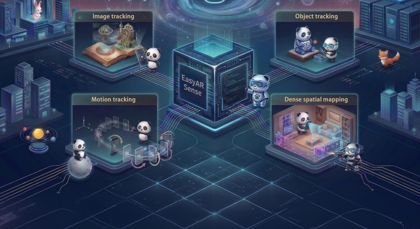
EasyAR Sense: Enhanced AR SDK
A professional cross-platform AR engine with core features like SLAM and image tracking.

EasyAR Mega: Large-scale Spatial Computing Service
Providing city-scale AR navigation and localization for urban landmarks.
EasyAR CRS: Cloud Recognition Service
Stable and efficient cloud-based image recognition with massive database support.
EasyAR Sense: Enhanced AR SDK
A professional cross-platform AR engine with core features like SLAM and image tracking.
 Make AR Development Easy

Product Capabilities
 Cross-scale: From consumer items to urban spaces.
All-scenario: Seamless indoor-outdoor transition.
High Robustness: Stable tracking in complex conditions.

Supported Platforms
Broad App & Mini-program Support: Native support for Android and iOS, along with WeChat, Alipay, and UnionPay mini-programs.
Flexible Engine Integration: Fully supports Unity, XR-Frame, and other major 3D engines, with custom engine integration available.
Extensive XR Device Support: Compatible with leading headsets including Apple Vision Pro, Pico, Rokid, and Xreal.

Developer Tools
Complete Toolchain: A full suite of development tools paired with powerful motion simulation features.
Flexible Multi-language APIs: Mix and match AR features freely to fit your specific needs.
Extended Input Support: Comprehensive input functionalities fully supporting the XR headset ecosystem.
 Complete Developer Support

 What's New
Today we launched EasyAR Mega on Product Hunt.Come and Vote!
The world is your canvas! Today we launched EasyAR Mega on Product Hunt.Come and Vote!
2026/07/02


EasyAR Mega Update Overview
The brand-new versions of EasyAR Sense Unity Plugin and Mega Studio are officially here!
2026/07/02

EasyAR Sense Unity Plugin Release Notes!
EasyAR Sense Release Notes
2026/05/18
 Showcase
Jingdezhen Heritage Gets an AR Transformation
The Digital Jingdezhen AR mini program uses EasyAR spatial computing to reconstruct historic kiln sites, add AR storytelling and travel-journal features, and create an immersive, accessible cultural-tourism experience.
2026/04/14

Technology Empowers Healthcare: EasyAR's Hospital AR Navigation Solves Medical Treatment Navigation Pain Points
EasyAR’s Follow Me hospital AR navigation solution overlays intuitive routes in real space, helping patients and visitors find departments more efficiently while supporting smarter hospital operations across multiple regions of China.
2026/04/14

AR History Beckons – A 45°C Summer Romance at the Ming Tombs
Powered by EasyAR Mega, the Ming Tombs deployed an outdoor AR-glasses tour with high-precision positioning, spatially anchored content and navigation, demonstrating stable operation in summer temperatures above 45°C.
2026/04/14