
EasyAR Cloud SpatialMap
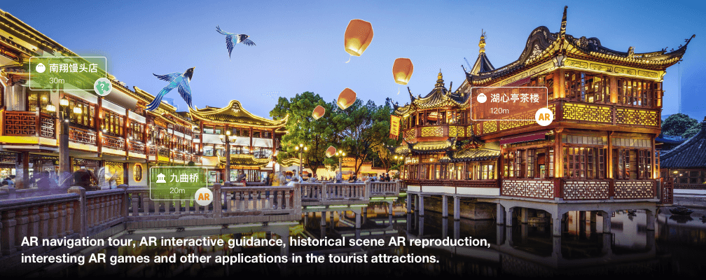
EasyAR Cloud SpatialMap provides city-scale AR cloud solution, and
empowers culture and tourism, business area, education, industry and
many other businesses with flexible acquisition scheme, leading
mapping and localization ability and user-friendly toolchain.
Benefits
Robust city-scale spatial map building
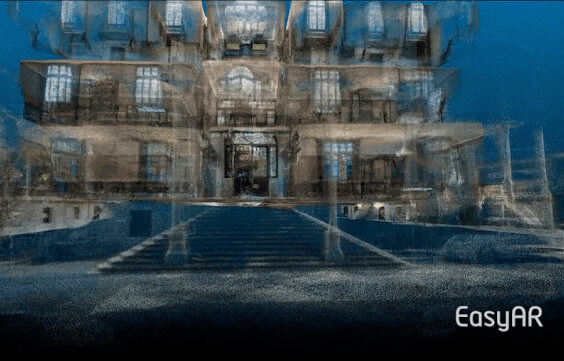
City-scale spatial map building
Generate maps within 24 hours, partially updatable
Highly accurate and complete 3D reconstruction
Flexible large-scale data acquisition methods
Ever-expanding public maps

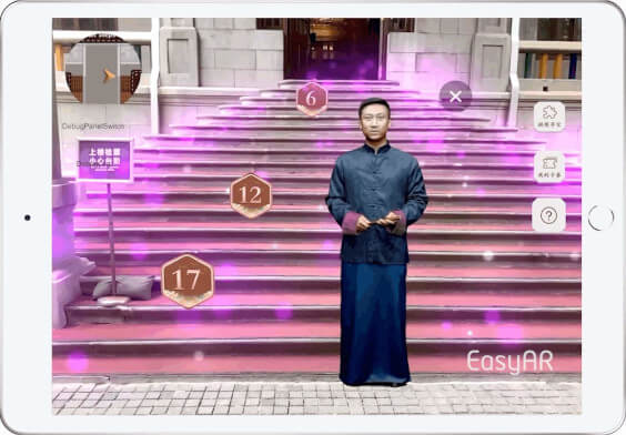

Fast, accurate and stable localization service
Centimeter level localization accuracy
Sub-second localization response
Stable and accurate motion tracking fusion
Private cloud and hybrid cloud deployment model support
Open tool chain for AR ecosystem
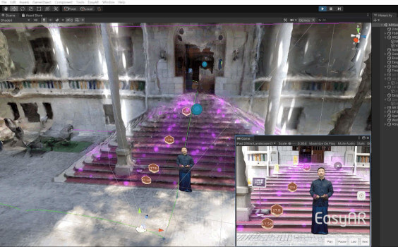
Efficient 3D map browsing and annotation tool
Validation against real-world simulation with pre-recorded data
Rich AR features provided by EasyAR Sense
Support native, web, and mini programs * Effects will vary between App, Web, and Mini program. Please contact us for details.
Support various Android and iOS devices and AR eyewear * Support Nreal, You can also contact us If you need to support other AR glasses.

EasyAR Cloud SpatialMap vs. EasyAR SpatialMap
Mobile devices
Panoramic camera
High precision equipment(Lidar or others)
Scale
High precision 3d model
Building time
Map update
Accuracy
Speed
Illumination robustness
Distance identification
Global/Local tracking fusion
Computation amount on device
Accurate placement
The simulation debugging
Ability to integrate EasyAR Sense
SDK(App)
Unity
AR glasses
Web
Mini program
EasyAR Motion Tracking
Unity AR Foundation
ARKit、ARCore
HUAWEI AR Engine


Industry Application Scenarios


Open area ready for using
View allChaoyang district,
Beijing-Business district
Chaoyang district,
Beijing-Shopping center
Haidian district,
Beijing-Scenic spot
Huangpu district,
Shanghai-Walking Street
Pudong district,
Shanghai-Software Technology Park
Heping district,
Tianjin-Scenic spot